Geographical Location
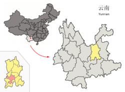
Guandu District is located in the southeast of Kunming,bordering Dianchi Lake in the north,Yiliang County in the east and Chenggong County in the south.It stretch 40.5km from east to west and 39km from south to north.The land area is 634.95 square kilometers.
Introduction
Guandu District is under jurisdiction of Kunming,Yunnan province.It is one of Kunming five urban core cities,which is located in the southeast of Kunming City.Guandu District is located in the north shore of Plateau Pearl-Dianchi Lake,which is an important part of the city of Kunming in Yunnan Province.
Administrative Division
Guandu District administers 10 streets:Guanshang Street(关上街道),Taihe Street(太和街道),Wujing Street(吴井街道),Jinma Street(金马街道),Xiaobanqiao Street(小板桥街道),Guandu Street(官渡街道),Dabanqiaqo Street(大板桥街道),Ala Street(阿拉街道)Yiliu Street(矣六街道),Liujia Street(六甲街道).
Ethnic Groups
There are Yi, Hui, Bai, Miao, Lisu, Zhuang, Dai, Hani and other ethnic minorities in Guandu District.
Guandu District in Kunming City
 Location of the 4 contiguous Kunming City Districts (pink) and Kunming prefecture (yellow) within Yunnan province of China | |
| Country | China |
|---|---|
| Province | Yunnan |
| Prefecture | Kunming |
| Established | 1956 |
| Area | |
| • Total | 552 km2 (213 sq mi) |
| Population (2003) | |
| • Total | 750,000 |
| • Density | 1,400/km2 (3,500/sq mi) |
| Postal code | 650200 |
| Area code(s) | 0871 |
| Website | http://www.guandu.gov.cn/ |
You will only receive emails that you permitted upon submission and your email address will never be shared with any third parties without your express permission.
