About Yunnan Natural Eight-Diagram(Bagua):
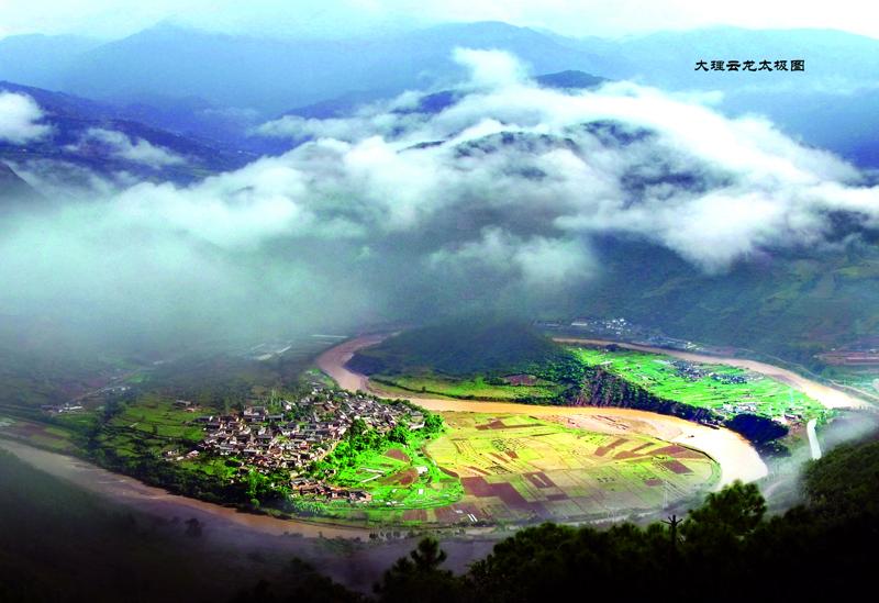
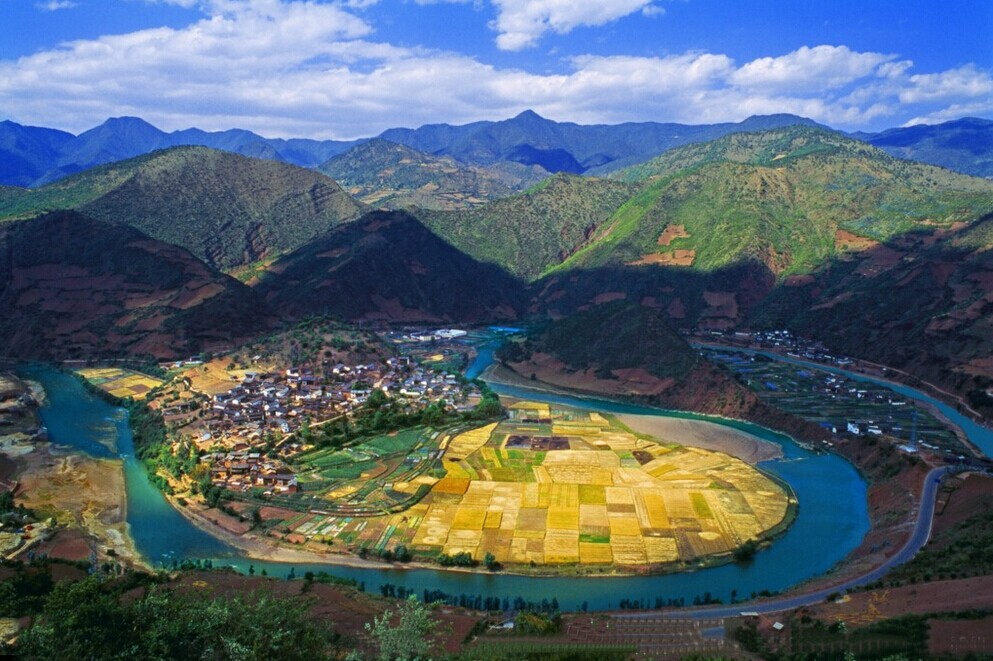
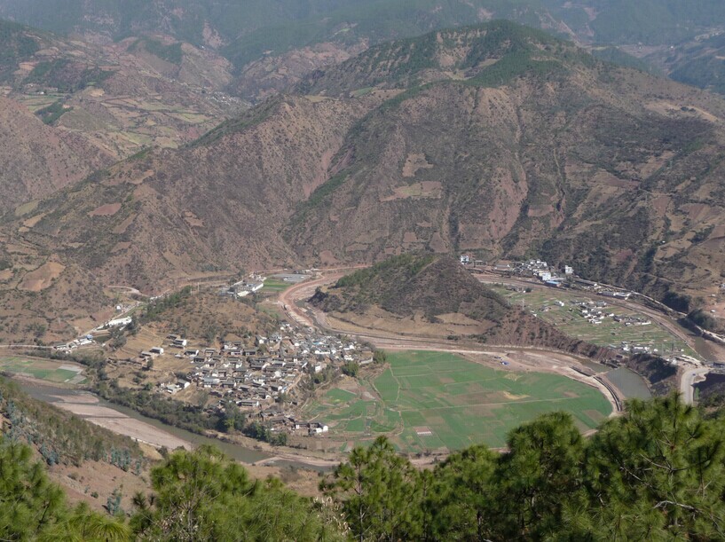
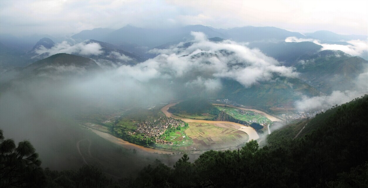
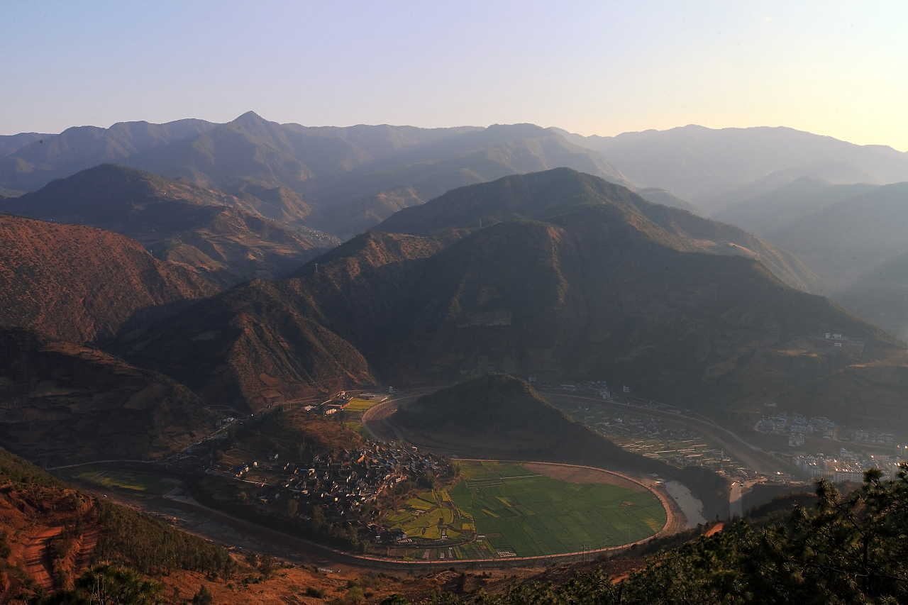
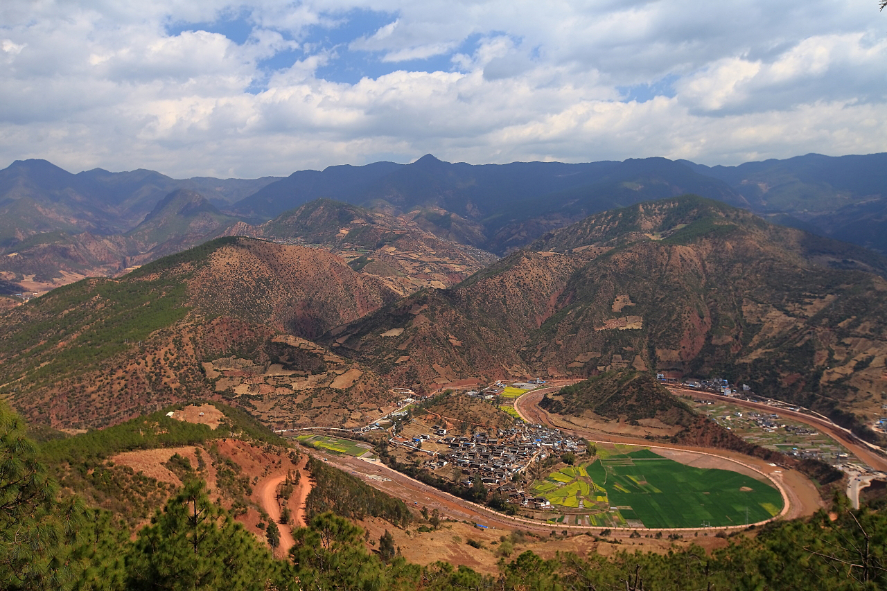
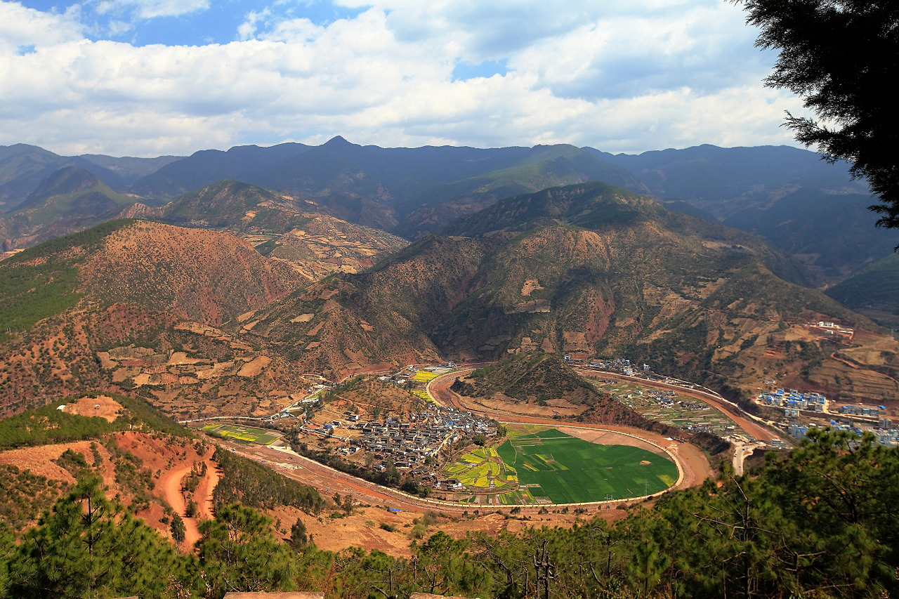
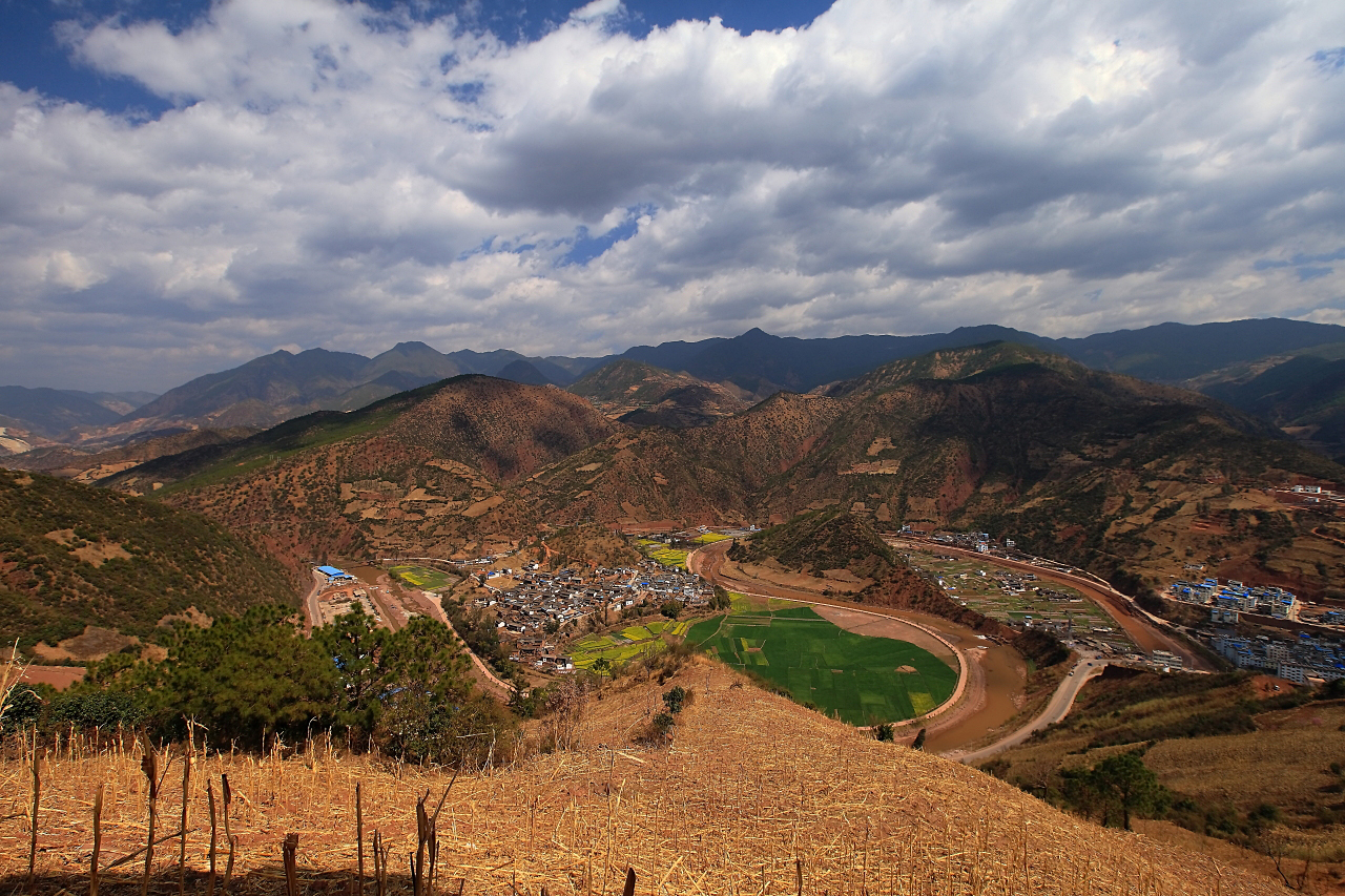
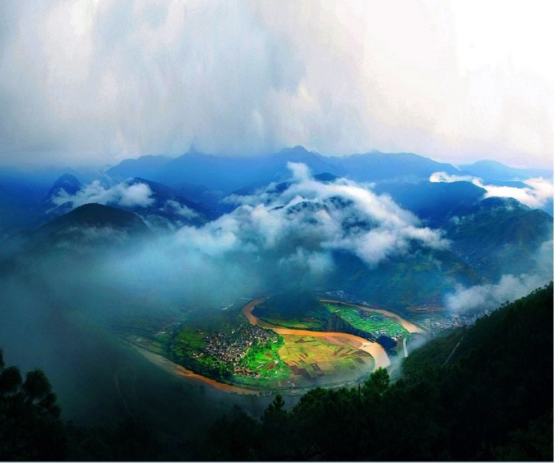
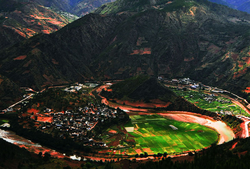
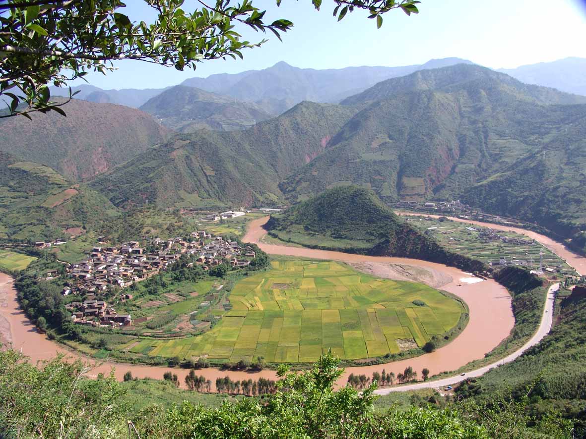
To the north of Yunlong county, there’s a river named Bijiang River, whose riverbed forms a shape of Taiji symbol. Because in Han Dynasty, Yulong county was called “Bisu ” county, the Bijiang River, in fact, means “a river in Bisu”. With a whole length of 173 km, the river curves into a big “S” shape when passing here, forming a natural spectacle of Taiji symbol. In this natural spectacle, the Zhuangping dam in the north and Lian-jing-ping dam in the south constitute the two fish-like patterns representing “yin” and “yang” respectively in Taiji symbol, making it more vivid. What is called “Taiji Symbol” is a symbol used by ancient Chinese to explain natural phenomena in the universe, showing the the law of unity of opposites between yin and yang. Normally, there are also Eight Trigrams arranged in octagon around the symbol. And it is always a symbol of Taoism.
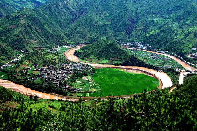
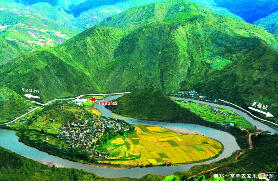
In fact, this natural Taiji symbol is a special land form formed by deep incised meander for more than three million years since the new tectonic movement in the quaternary era of geologic time. This land is 880m wide from east to west and 1000m from south to east, is a round basin in the north suburb of Yunlong county. To the northeast and south of the symbol, there are groups of taoist constructions, and to the northwest, there lying the famous “Pearl of the West Yunnan Plateau ” ----Tian Pond. Nuodeng river pours into Bijiang river through the very middle part. Therefore, this pattern is also called “Taiji locks up water”. What’s more, the hill on northern Zhuangping dam is like a lion’s head, and the hill on southern Lian-jing-ping dam is like a trunk of elephant, thus people called this “Lion and elephant guard the gate” for Nuodeng village, which is a Bai village with a history of more than a thousand year, lying 4km away from the Taiji symbol.
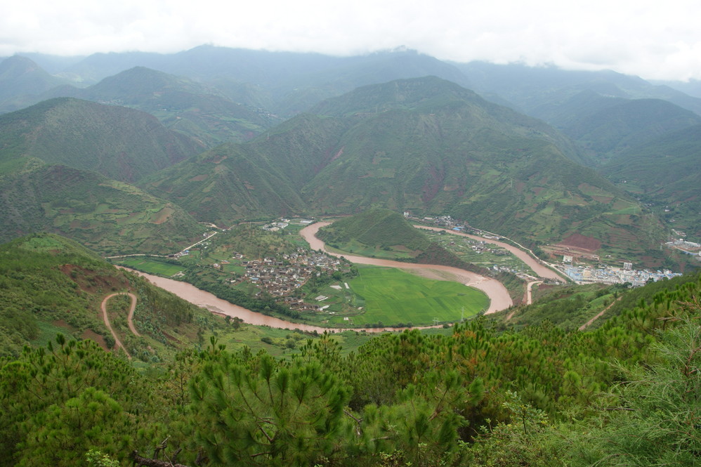
The mountain to the west of Taiji symbol is called Chicken Tail Mountain, where you can find a observing platform---a perfect point to enjoy the sight of Taiji symbol. On the right of the ovserving platform is a highway leading you to the beautiful Tian Pond, 14km from here.
While waltzing along the Bi River towards Nuodeng, you’ll walk right past this amazing coincidence of nature and not even realize it£®Or, even if you know it’s there, from the ground you can hardly appreciate it£®
This is where nature really can seem to be messing with you£®The Bi River here is forced into a serpentine roll, and the result, seen from above, is a remarkable naturally formed Yin-Yang symbol£®When the weather is right-cooler nights and warmer days, especially November through January according to locals the mists here are preternaturally lovely£®Best photo—op times are mid to late afternoon£®
To get to the pavilion at the prime viewing point, you could theoretically hike the seven or so kilometers£®The trouble is, it’s a long, tedious slog uphill along a gravel road with endless switchbacks£®(The rise is only 300m, but it seems like a lot more£®) If you’re up for it, at the gas station in town head west across the bridge. About 50m after you see a sign saying 22km go left and up a stone road and start the trek£®
Yunlong Diagram is a landscape wonders. Although it is Tertiary tectonic After several millions of years of river erosion formed a natural product, but no matter how said that he and the Chinese people are very familiar with the ancient Taoist a logo - tai chi, is too alike, so we call it "natural Diagram." "Natural Diagram of the" Dali Bai Autonomous Prefecture in Yunnan Province, the northern part of Yunlong County. There is a river called Bi Jiang, the river around an "S" type of Grand Bay, and formed a similar "Diagram of the" natural wonders, "tai chi" on the cathode and anode two fish Pingba, and traditional Taoist logo similar to exactly the same.
More interesting is that in this "natural Diagram," a hill south of Yunlong County Danmentian Hutoushan Taoism buildings, the east hills have historical and cultural village in Yunnan Connaught Tang Village Yuhuangge Taoism buildings, " harmony between man and nature "of the natural landscape and human landscape organically unified in the ancient Taoist culture and ideology. Taoist classic "Taoist Tai Chi birth of the map", said: "Tai Chi also, heaven and earth Wallace Jerusalem, space-tai chi, everything the world." In the far southwestern border of the motherland Yunlongshan area, it contains such a profound and Taoist teachings belief in worship forms, which makes people feel surprised.
Nuodengcun Village in Connaught Yuhuangge Basilica "caisson," and so far, we can still see a "four images and the stars nosy 28" pictorial, it can be said, today it is also a unique cultural and artistic treasures of Taoism. Jade Emperor in ancient god of this Block "caisson" said East map out landmarks, the North basaltic, Western white tiger, the South rosefinch 28 Suitengumae map the stars, constellations here each corresponding with the shape and only those in the "Book of Mountains and Seas "One of the classics can be seen in various animal pictures were painted in the image of this lively and colorful, lifelike. Taoist view of the constellation of Creation Wizard, and Diagram of the Creation is the Schema Generation, "Tai Chi Sheng Liang Yi, Liang Yi Sheng four images, four images Health nosy," in the "Tai Chi nosy map", "caisson" this should be a central "tai chi" symbols, we can see only the periphery "nosy" logo, but it is the middle of the air, why is this so? This is a fan of. However, as long as this Yuhuangge southwest close to the "natural Diagram of the" one, maybe you can imagine that the ancients on the wisdom and motives are coming!
Admission Fee:¥0

You will only receive emails that you permitted upon submission and your email address will never be shared with any third parties without your express permission.
